Montag, 29. Februar 2016

Outback, last day

It was already dusk when we arrived at the Rowles Lagoon yesterday and I profited from the last light rays to put up my tent, after what I went a swim and wash up in the lagoon.
In the morning I was glad that I couldn't see the color of the water because it felt very good to get rid of the dust and if I had saw it I would probably not get in.
We had a couple of storms passing by in the night and it seamed that it would rain again during the day, the plan for the day was to visit Lake Ballard and have a look at the statues. On the in saw the first kangaroo alive since I got to Australia. I had been warned about the road conditions when it rains, they should get very slippery and quite hard to stay on the bike in some spots. Today I had the chance to experience it, when you look at the 8 to 10 meter wide, flat and straight road, the last thing you'd think is that it could be dangerous but I was very glad to be ridding carefully when my front tire started to slide to the right while my rear tire went to the left, it's just like black ice on the road you just don't know what the bike is going to do next.
When I finally hit the sealed road near lake Ballard I noticed that something was wrong with my front tire, after a closer look it seamed like I had punctured it. While the others went to see the statues, I stayed at the information point pumping the tire and trying to find out where the air came out. The front rim was looking like this but the problem was the valve, it was loosing air, just don't know why it appeared to have started just now.
The lake has 51 statues that where installed to commemorate the 50th anniversary of the Perth International Arts Festival in 2003 by acclaimed British artist Antony Gormley, unfortunately there was water in the lake and I could not get near the statues.

Sonntag, 28. Februar 2016

The Outback III

In the morning we packed everything and moved on to our next campsite at Rowles lagoon. On the way there we stopped at the top of the hill near the Jaurdi's homestead to check the net and inform that everything was fine with us. Then was easy going until Wallaroo Rock where we stopped for lunch and I tried to find a solution to mount GPS back on the bike. 
From there John and Steph took the easier route while Neal and me rode the shortest path to the Credo homestead. The track didn't seamed to have been used lately and was quite easy to ride at the beginning even if quite narrow, but later we started to hit sand and the longest strait didn't reach 50m, quite challenging and exhausting, changing direction all the time and it went like that for the next 20km , you can't imagine how happy I was when we finally had a long straight in front of us. During all that stretch I was thinking about the reasons that led someone to build it like that and if alcohol was part of the motive :D because there are no trees around you'd need to avoid.
After another 20 km ridding up and down, we got to the first crossing, where one of the tracks seems to go almost straight to Credo and that was the one I chosen, it is a narrow track full of washouts, hard mud and again... sand.
It all went well until we got this tree on the way.
 Shortly after got in this uneven deep sand washed from somewhere further up, with holes over a meter deep and big enough to hide the bike in there.  
No further difficulties until Credo where we where friendly welcomed and offered tee and cake by the current care taker. We waited there until the storm that was coming in our way passed by.
Rowles lagoon where we settle for the night is only a couple of kms away.

Donnerstag, 25. Februar 2016

The Outback II (Part 2/2)

After a short rest and a look around at the Mount Elvire Station, I rode to the outcrops that were visible from the station thinking they were lying on our way back but had to turn back as there was no way out.
The next 80 to 90kms were pretty fast, apart from a 500m stretch of deep sand with a corner and gate in the middle.
Then the track became again more technical and the speed dropped considerably while the sun got deeper in the horizon. On our way up we left the peak of the Helena and Aurora Range for later, now John suggests that we should try to get to the top before sunset. It was already dusk and with these two different hills ahead of us I was wondering about which them we were about to climb, both look near but the track seems to go just in between. Finally we started to get higher and the technical demand, so late in the day with already over 400 kms behind, made me wish I was ridding something much lighter. The rocks got bigger and the rain water created ditches deeper, often leaving only a single trail available for progression and by the time we got to the top, we were more doing trial than enduro. The view from there however was overwhelming and rapidly made me forget all the necessary efforts to get there.
After a while enjoying the landscape, we drove down and took a different route to the bottom that was supposed to be shorter and it actually was but not easier. There was no way we could ride that track down on the bikes and the short stretch we had ridden was not an alternative anymore, it was too steep and too rocky to go back. With no available plan B we carefully carried the bikes down one by one but by the time they were all save at the bottom, it was already dark and we had at least another 80 kms to go.
I jumped on my bike and after a couple of meter realized that I had only the first gear and neutral, the second just didn't got in. One of the rocks on the way down must have bent the engine guard. John bent it back a bit and of we go again. A couple of kms later my reserve light went on and a range of 50 kms appeared on the board computer, not wanting to stop again I kept on going, depending on the real distance, the fuel could be just enough to get to the camp with the last drops. At around 30 kms later John stopped at a crossing where a mining warning sign and a not entry blocks one of the roads, Neal says is also running on reserve and we split out the reserve fuel we were carrying between the two bikes. Ignoring the warning sign and driving through the mining camp would save us a lot of time and we wouldn't need to ride that deep sand from the morning again, so we decide to go for it. I don't really know what to expect if we're caught and feel a bit uncomfortable ridding that track, not long after my bike began to feel strange, I stopped to take a look and "yeah right, just what we needed now" a flat tyre, placed the bike on the center stand and started to search the motive, the bike is running on tubeless so no need to take the wheel off, but what I saw was not very encouraging.
 Yeap! That big
The hole was huge and after our repair try was still slightly loosing air somewhere but we decided to move on regardless as there were not much more CO2 canisters remaining. After another short drive we arrived at the mining site and tried to get around without getting noticed but didn't succeed, we claimed to be lost, not knowing how to get through to our campsite and they offered to help us with air, water and then guide us to a defined crossing from where we claimed to know our way back. By the time we finally got to the campsite it was already after 10:00 pm.

Dienstag, 23. Februar 2016

The Outback II (part 1/2)

Next day we rode to Mount Elvire homestead, John said something about over 500 kms so no time to stop for pictures, because otherwise we would run out of time and I thought "is he really serious about it?"
I remember doing around 450kms offroad and it being quite exhausting but having ridden some wide gravel roads in the last days where you could easily do 200km/h on them, thought he knew the track conditions and besides being a long and exhausting day it would be alright and a plan B or a shortcut would make part of the plan.
We left the campground at around 7:40am and shortly after would be doing around 60 kms deep sand ("Comporta like" on a sunny day by 34C degrees, for the ones that have ridden there) on a car wide track, regardless of terrain difficulty when ridding a Varadero with 19' front wheel, it was really fun but all this time I couldn't take my eyes of the track and didn't notice that my GPS support had gone loose and by the time we stopped it was hanging around and a screw was already missing, that was it with GPS for the day. I placed it inside the tank bag to save the track but later realized that it had no reception in there. Besides that I forgot my camera on the campground, fortunately today's smartphones have cameras, and as I had misused the ram mount to hold the GPS, I know could use it for the video cam, set to automatically take pictures every couple of seconds :-)
Back on route the ground changed to solid mud, gravel then rocky with stretch of sand at least every 500 or 1000 meters and the color was constantly changing.
Tank refill in the middle of nowhere.
After the refill, John let me go first to have a chance to see some wild life, no turns or crossings for the next 25 km, the next pictures should give you an idea how the soil color keeps changing.
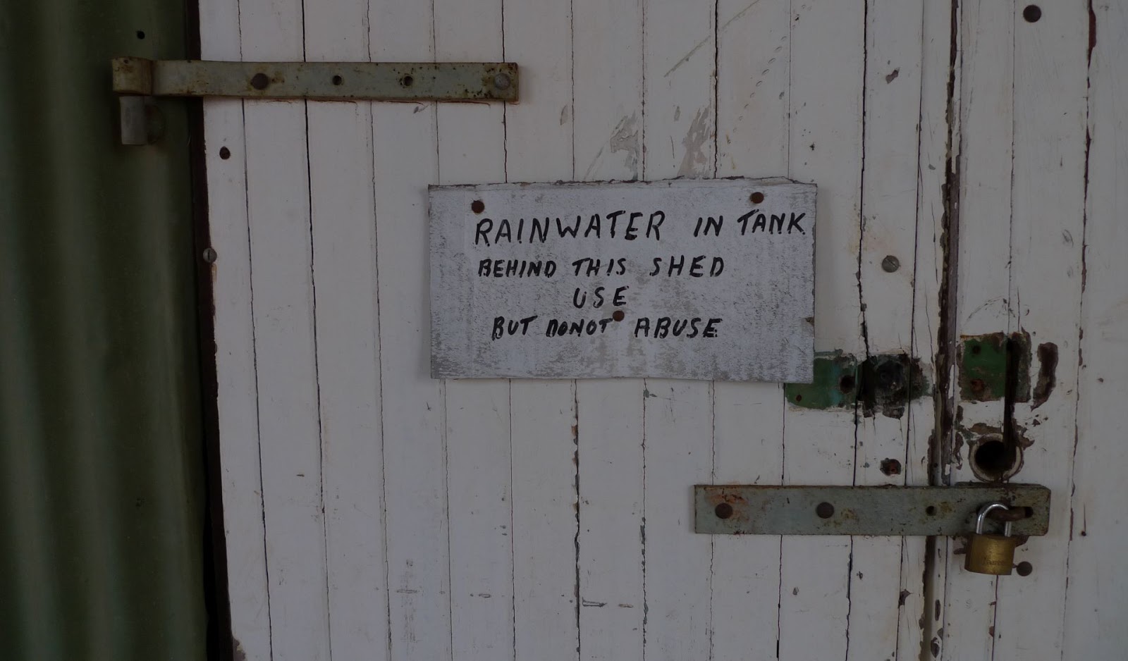
Then we stopped at a mine camp to get some extra rain water for the way.
Now, by looking at the pictures, I see that the soil seams pretty solid but the reality is quite different, the weight of the Varadero breaks the thin layer and below it's all sand and keeps surprising your feelings.
Stop at the first crossing to wait for John and Neal.

Lake Barlee, only salt no water ;-)
Mount Elvire homestead, half way done and already over 200 km done and another rain water refill, the day is going to be long.
 To be continued ...

Montag, 22. Februar 2016

The Outback

There has been slightly change of plans, instead of Thursday afternoon we started from Kalgoorlie on Friday morning and hit the last gas station Coolgardie shortly after, I had planed to buy an extra bottle of water there but in the hurry just filled up an forgot about the water.
The first stop was in Boondi rock for a quick breakfast and a look around. Boondi was one of numerous rock catchments in the Great Western Woodlands developed for railway water supplies in the days of steam engines.
Back on the main road we drove about another 6kms before we headed to Ive rock on a well maintained unsealed road.
That became more demanding and less maintained some distance ahead, with sand spots every now and then.
On the way there we shortly stop hat the Jaurdi homestead and around noon we're pitching our tents at the camping ground.
 
John had stored some fuel there the week before and after the bikes were refilled we went for a ride around and visit some old abandoned mines  where I later had the chance to get some additional rain water to drink and John organized a grill grid from the available metal rubbish for the barbecue, he had mentioned something about steak and cold beer on the first night but I actually thought that he meant before we get on the tracks, what a nice surprise.
Imagine that you ride over a hundred on unsealed ground, then you finally come up to a nice sealed road and there are these two traffic signs just before it WTF?
find the dragon :-)
Make an educated guess about which bottle is filled with rain water :-)